Aerial Mapping

Drone Mapping Services

Aerial mapping using UAV’s provides a complete visual and data rich record of your work site or land area. A periodic mapping schedule allows site managers and stakeholders to monitor changes to ensure a project is being carried out to plan and on time. They assist greatly in ensuring a project is completed correctly, on time and on budget.

SAMA TWAIQ has optimised a process from years of experience in the field capturing photogrammetry data to provide a deliverable that has proven to be so useful in the planning and decision making process throughout a projects life cycle that cost and time efficiencies have vastly improved.

A Single Source of Truth for All Stakeholders

The 2D and 3D maps can be accessed from anywhere with an internet connection allowing easy access for all stakeholders. This eliminates any discrepancies between personnel who have undertaken on site visual inspections as everything can be recorded, stored and readily available.

The Benefits of Working with SAMA TWAIQ

Accuracy

To ensure the success of your project and the investments made by shareholders, we take extra care to ensure the data we provide is accurate and detailed. The advanced technology we use allows us to create a 3D reconstruction of any environment, regardless of the terrain. We are able to provide certified surveys that are up to 3cm accurate with the use of ground control points if needed.

Faster and less costly

Our experience conducting UAV surveys allows us to collect data about your property faster and cheaper than traditional surveying methods. By using our services, you can focus less energy on gathering data and more time analysing the results.

Projects that can take days or weeks can be completed in a sliver of the time using task specific inspection drones. Being able to easily position themselves with high-quality cameras and sensors allows incredibly quick acquisition of data at a quality which cannot be matched with manned access. The time it takes to set up cranes, elevated work platforms, rope access can make a huge impact on the time it takes to complete a job not to mention the difficulty of moving around the structure.

Safer

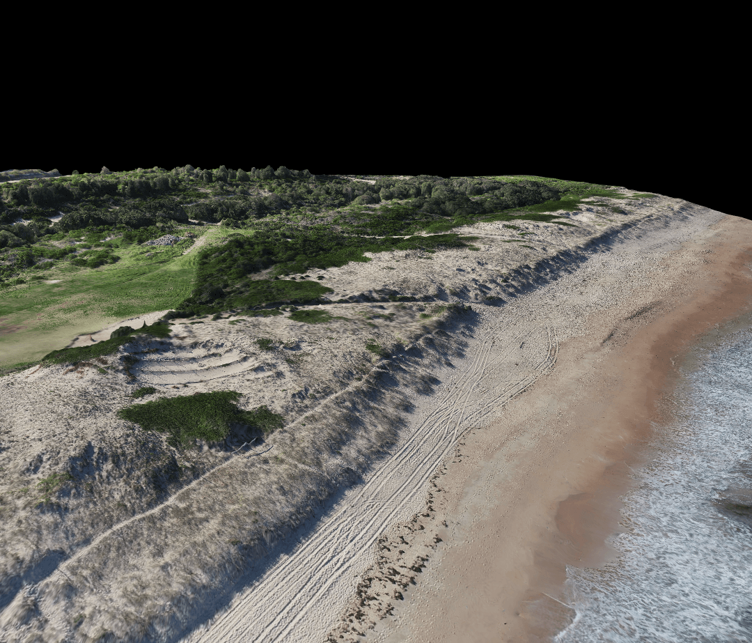
As opposed to traditional survey capture we can map an entire site using a drone with the potential to conduct the operation from outside the area. Drones will also clearly expose locations on site that have unstable structures, shallow excavations, or other hazardous areas that are generally risky due to the poor workmanship during construction. Therefore improving the safety of all workers on site.
Agriculture SAMA TWAIQ

Agriculture

Stockpile volume calculation SAMA TWAIQ

Stockpile volume calculation

Contour mapping SAMA TWAIQ

Contour & mapping

Property or site survey SAMA TWAIQ

Property or site survey

D Modelling SAMA TWAIQ

3D Modelling

Image Gallery

Frequently Asked Questions for this Product

SAMA TWAIQ can accurately map an area up to 100ha per visit.
SAMA TWAIQ can work with your existing surveyors to increase global accuracies. If our ground control system does not suit your site for any reason, you may ask your existing surveyor to establish several known points around the site and supply us with this information. We can utilise this data to improve the global accuracies of our processed maps.
If we use ground control points, we can achieve accuracy up to 3cm. Otherwise, using the GNSS system within the drone it could be up to 1m. Contact us to see what will work best with your site.

Ask for a quote for aerial services. Our drone experts are at your disposal.